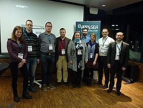
The sun had already moved behind the mountains surrounding Tromso and the blue hour had set in. It was only early afternoon, but the daylight for Wednesday had been almost used to the end. But the day was not over yet, the APP4SEA partners were just getting started. Now it was time for them to shine and tell the listeners about Arctic oil spill response issues. The meeting room on the top of the Clarion Hotel Edge in 11th floor provided a good view of Tromso and the partners provided a good overview of challenges and risks related to Arctic oil spills. Eva Pongrácz from University of Oulu opened the event with a presentation about the project itself. She was followed by Jorma Rytkönen from Finnish Environmental Institute, who put the main issue under focus, how well prepared we are to deal with potential oil spills in the Arctic region and what tools we have to combat them. Because of the Gulf stream Northeastern Atlantic is largely ice free, but ice is a factor, which has to be taken into consideration. As northern parts of the Baltic Sea have ice for several months in winter time, many Finnish companies have been developing methods and equipment, skimmers and brushes, which can be used in icy conditions. Still, it would be best that ice and oil would not mix and oil spills could be avoided in the first place.
If oil spills do occur, quick response time is of essence. Lars Hole from Norwegian Meteorological Institute (NMI) told about oil drift modelling in Arctic waters and in particular about the Open drift model developed by (NMI). Oil in water can spread to large areas with currents within relatively short time. This depends also on the characteristics of the oil, but oil drift modelling is the key tool in estimating the spreading of the oil and implementing correct counter measures on the right place, at the right time.
One additional factor, which might have importance as these decisions are made, is the potential damage that the oil spill can cause to nature and animal populations. Nina O'Hanlon put these under the loop, as she presented the research done related to oil vulnerability of the seabirds, which had been done at the the Environmental Research Institute of the University of Highlands and Islands. Earlier on the researchers at ERI had calcualted the OVI index of the birds and now this information was put on a map. The map highlights the areas, where potential oil spill would do most damage to the bird populations. This information will be included in the smart map, which was the next item on the agenda. Thorsteinn Steinarsson from University of Iceland gave the audience an overview of the map designing process and gave them a glimpse of the map itself.
Presentations of the event are available below.

